Subject: Japan
Period: 1850 (circa)
Publication:
Color: Printed Color
Size:
252.5 x 6.5 inches
641.4 x 16.5 cm
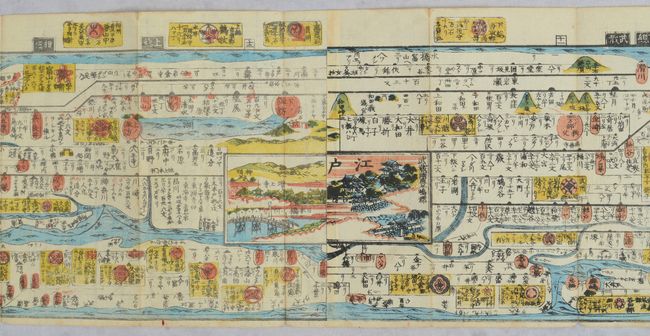
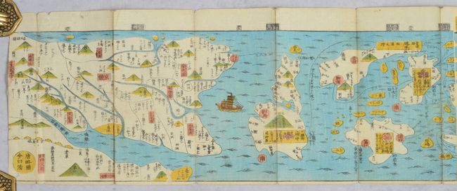
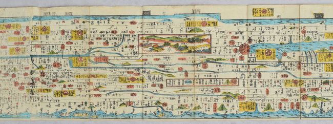
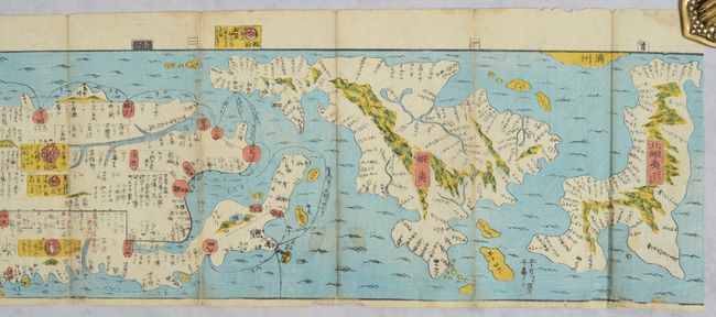
This incredible woodblock strip map depicts the early road system of Japan and measures an impressive 21 feet long. The map extends from Hokkaido and the disputed Northern Territories to the southern tip of Korea (Kingdom of Choson), with a trade ship depicted traveling from Japan to Korea. Issued on 12 joined sheets, the map focuses on important transportation routes, including waterways and the Five Highways of the Edo period: Tokaido Road, Nakasendo (or Kisokaido), Koshu Kaido, Oshu Kaido, and Nikko Kaido. Several inset views of cities along the highways are included. The map was compiled by Yamazaki Yoshinari. This example is missing the original paper covers, but is otherwise complete.
References:
Condition: B+
Very good condition for this type of item, with light soiling, a few small worm holes, minor misfolding, and light wear along the folds.