Subject: World
Period: 1638 (circa)
Publication:
Color: Hand Color
Size:
14 x 9.9 inches
35.6 x 25.1 cm
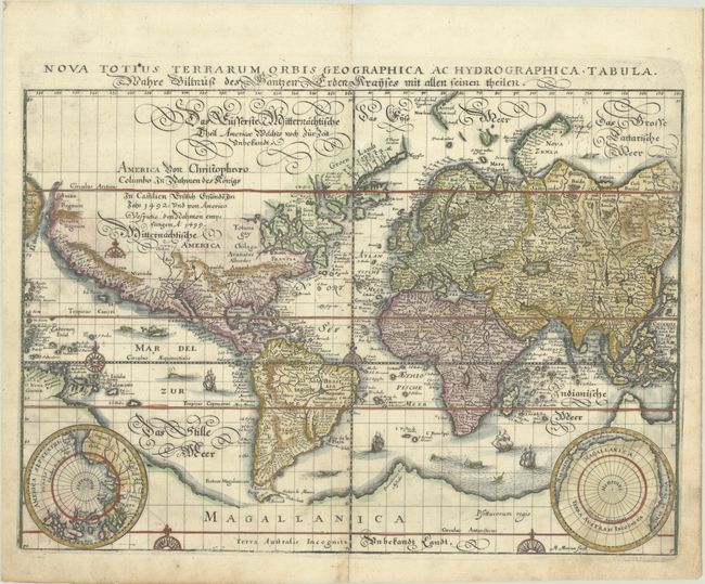
This beautifully engraved world map is presented on Mercator's projection with cartography closely copied from Blaeu's world map of 1606. The Latin title is printed at top, outside the neatline. A German gothic script title and notation concerning the discovery of the Americas in 1492 covers the unknown interior of North America. California is a peninsula, and plenty of open ended waterways in the eastern part of North America leave open the question of a Northwest Passage. Two polar projections in lower corners partially obscure the great southern landmass that is connected with New Guinea. The map is finely decorated with sea monsters, galleons and compass roses. This is the first state, with Merian's signature in the plate at bottom right.
References: Shirley #345.
Condition: B+
A nice impression on a bright sheet with an eagle watermark, light soiling, and a professionally repaired tear that just enters image less than 1/4" at bottom center.