Subject: Shanghai, China
Period: 1932 (published)
Publication:
Color: Printed Color
Size:
29.6 x 20.2 inches
75.2 x 51.3 cm
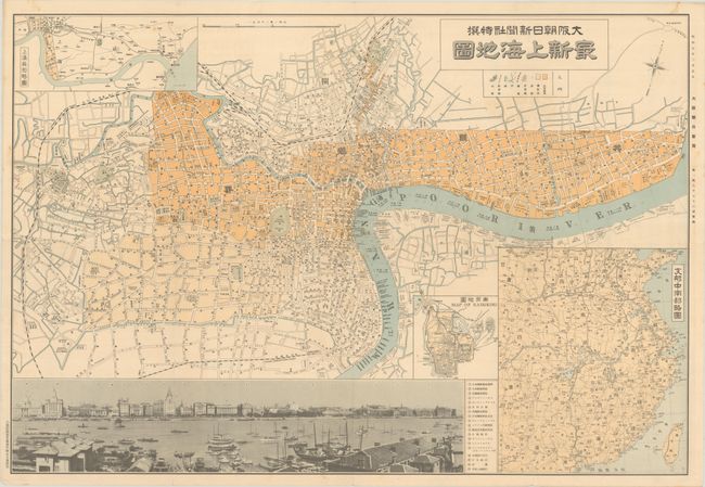
This detailed map of Shanghai was published shortly after the First Shanghai Incident, in which fighting broke out between Chinese and Japanese nationals in Shanghai. The map includes a large inset of China and Taiwan showing roads and railways, as well as smaller insets of the city of Nanjing and the Wusong area of Shanghai. Street names are given in both Chinese and English. At bottom is a panoramic photograph of the historic waterfront skyline of the Shanghai Bund, with a numbered key at right identifying various locations. Published by Toppan Printing Company.
References:
Condition: B+
Issued folding with a few of short fold separations and a small hole at a fold intersection. There is very light soiling and a couple of tiny tears along the edges of the sheet.