Subject: China
Period: 1938 (published)
Publication:
Color: Printed Color
Size:
23.5 x 33.8 inches
59.7 x 85.9 cm
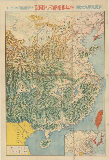
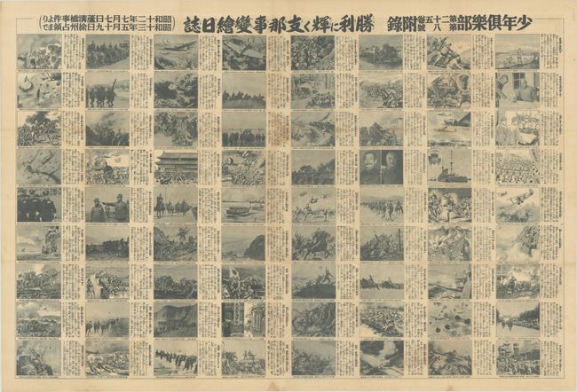
This pictorial map of China is filled with images of local people and animals to illustrate various industries, such as farming, mining, and fishing. The map identifies key cities, major landmarks (such as the Great Wall), roads, and airfields. An inset map at bottom shows the airplane and shipping routes throughout East Asia. This charming map is oddly devoid of any hint of the ongoing Second Sino-Japanese War, which had begun a year prior to the map's publication. This omission is rectified on verso with 72 black and white images with accompanying captions related to Japan's military invasion of China depicting "A Picture Diary of the Shining Victories of the China Incident." Designed by Shimada Keizo and published on June 8, 1938 as a supplement to Shonen Kurabu, a monthly boys' magazine.
References:
Condition: B
Issued folding with several areas of darker toning. There are some short splits and small holes along the folds with minor loss of image.