Subject: Eastern Asia
Period: 1688 (circa)
Publication:
Color: Hand Color
Size:
11.1 x 18.1 inches
28.2 x 46 cm
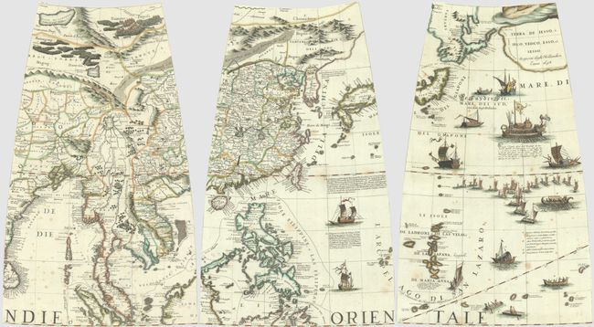
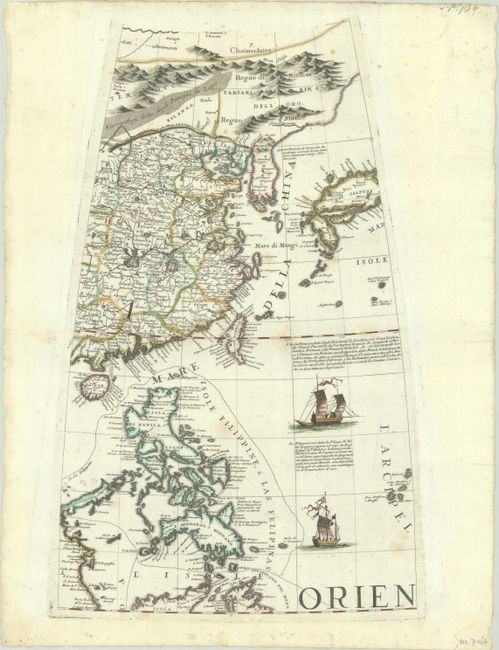
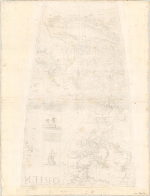
This lot includes three elegantly-engraved globe gores from Coronelli's 3.5-foot terrestrial globe. The first gore, based largely on Jesuit sources, spans from the mountains of Northeast China south to show part of Borneo and the Maluku Islands. China is divided into provinces, with plenty of place names and the Great Wall of China graphically depicted as its northern boundary. In a note on Formosa (Taiwan), Coronelli refers to the Chinese pirate/commander Coxinga holding possession of Bell'Isel, ou Ilha Formosa, da' Portoghesi Laqueio, even though he had died in 1662, well before the map's publication. The Korean peninsula is taking shape, with a note nearby stating that some believe it to be an island. The Japanese islands of Giapone (Honshu), Tonsa (Shikoku), and Bungo (Kyushu) are located, albeit in misshapen form. The Philippines are depicted in full.
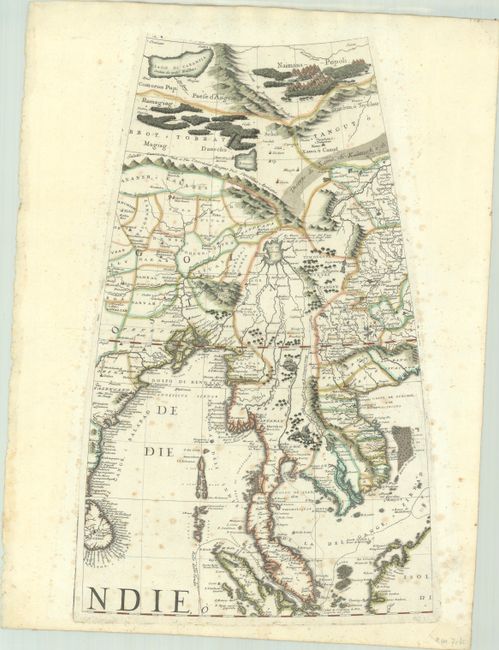
The second gore centers on Mainland Southeast Asia, extending west to include the east coast of India and Sri Lanka. In the north, there is a large Lago di Carantia that was removed from Coronelli's later maps of Asia and a pictorial tent encampment of the Naiman tribe. The spurious Lago di Chiamay, or Cunabetee is presented as the source of several rivers flowing south. Herds of elephants roam in the vicinity of present-day Myanmar and Thailand.
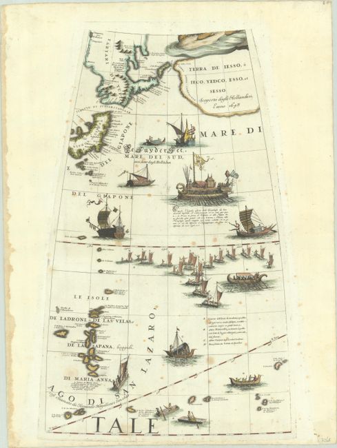
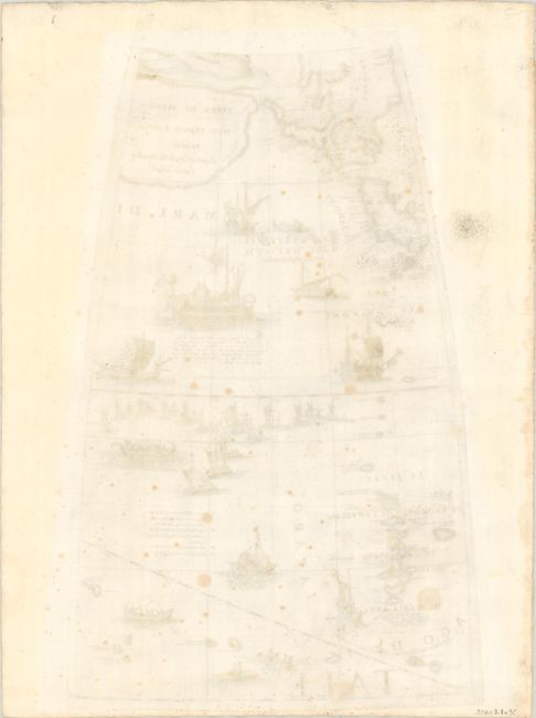
The third gore is highly decorative, with intricately engraved ships and vessels filling the waters. Helpful notes in Italian text describe the watercraft of the region. The map depicts the eastern part of Honshu, including Iedo (Tokyo), with some interesting conjectural cartography beyond the island based on the expedition of Maarten Gerritsz de Vries. In 1643, de Vries was commissioned by the Dutch East India Company to explore the region north of Japan in search of Rica de Oro and Rica de Plata, fabled islands of gold and silver. Across the Stretto di Zungar, or Sangaar from Niphon, et Gipuen is Tartari de Yupi, which resembles the southern part of Hokkaido. To the east of this landmass is a small island labeled Terra degli Stati, de Vries's "Staten Eylant" or the present-day Iturup. Farther east, past the Stretto d' Vriez, is large, vague landmass, named Terra della Compagnia along its western coast and Terra de Iesso, o Ieco, Yedco, Esso, et Sesso inland. The map also spans south to the Mariana Islands.
Vincenzo Maria Coronelli was a Franciscan priest and renowned mathematician and cartographer. He became Italy's most esteemed cartographer and globe-maker, producing over 500 maps and globes in a stunning Baroque styleover his illustrious career. In 1684-85, he was appointed official Cosmographer to the Venetian Republic and founded the world's earliest geographic society, L'Accademia Cosmografica degli Argonauti.
References:
Condition: B+
Crisp impressions, with the first and third gores on paper with the watermark of three crescent moons. Each gore has light foxing and a single tiny wormhole at right. There are remnants of hinge tape in the corners on recto, well away from map images.