Subject: Northern Asia
Period: 1791 (dated)
Publication:
Color: Hand Color
Size:
27.7 x 16.8 inches
70.4 x 42.7 cm
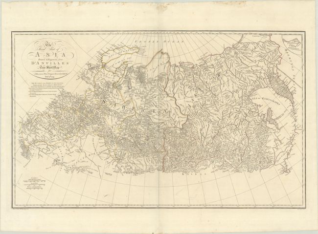
A detailed and expansive map of the Russian Empire in Asia extending from the Caspian Sea east to the Bering Strait. Nova Zembla is shown as a single large island with the Dutch discoveries noted on the eastern tip. In the Pacific, Etorofu is referred to as Terre des Etats and the western side of Urup is Terre de la Compagnie. The map is filled with rivers, mountains, place names, and political boundaries. There are three distance scales and cartouche with fancy titling.
References: Shirley (BL Atlases) T.HAR-1a #8.
Condition: B+
Contemporary outline color with a few spots of foxing. There is some minor staining along the top sheet edge and a short archivally repaired centerfold separation confined to the top blank margin.