Subject: Asia
Period: 1750 (circa)
Publication:
Color: Hand Color
Size:
24.3 x 19.1 inches
61.7 x 48.5 cm
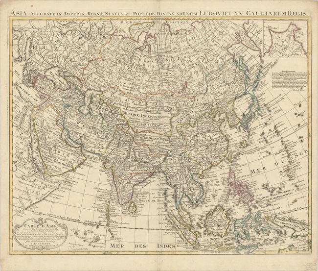
This scarce map of Asia is a revision of Delisle's 1723 map of the continent, reflecting the surveys of Vitus Bering between 1725 and 1749. In this map, Covens & Mortier complete the coastline of northeastern Siberia between Novaya Zemlya and Japan, with Novaya Zemlya correctly shown as an island and the peninsula of Kamchatka now appearing. A small inset at top right shows the northeastern tip of the continent. Hokkaido (Jeso-Gasima) is no longer attached to Japan but is still poorly shaped. To the east are the conjectural islands of Terre de la Compagnie and Terre vue par J. de Gama, both of which are only partially delineated. The map includes a group of islands labeled Nouvelles Philippines to the east of the actual Philippines.
References: Yeo #149.
Condition: A
Nice impression and contemporary outline color on very sturdy paper with a few tiny spots and a faint horizontal crease.