Subject: Holy Land
Period: 1650 (circa)
Publication: A Pisgah-Sight of Palestine
Color: Black & White
Size:
13.1 x 11.3 inches
33.3 x 28.7 cm
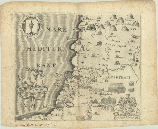
This map depicts the lands of the Tribe of Asher in northern Palestine. It extends from Sidon to Acre and locates Bethlehem, Tyrus and Aphek. The map is filled with biblical illustrations and is adorned with an elaborate coat of arms and dedication to Leonardo Gleane.
Thomas Fuller (1608-1661) was a respected English clergyman who wrote several books on the history and geography of the Holy Land. His A Pisgah-Sight of Palestine, published in 1650 and again in 1662, was a geographical description of the Holy Land with special reference to biblical history. The maps were derived from the cartography of Adrichom supplemented by his own wide reading. Fuller financed the book by dividing it into sections and finding sponsors for each one. To acknowledge the patrons, all maps contained decorative cartouches with the sponsor's coat of arms and a dedication to him.
References: Laor #284; Nebenzahl (HL) p.128-131, #5; Shirley (BL Atlases) G.FULL-1a #6.
Condition: B
There is scattered foxing, small wormholes along the upper centerfold, and a stain along the lower centerfold. Several printer's creases are mostly confined to the blank margins.