Subject: Holy Land
Period: 1632 (circa)
Publication:
Color: Hand Color
Size:
31.6 x 12.4 inches
80.3 x 31.5 cm
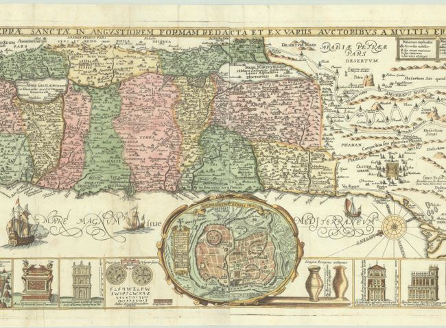
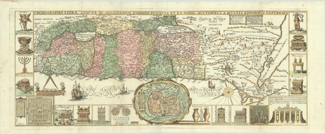
Panels illustrating sacred objects surround this stunning map of the Holy Land. Oriented with east at top, the map includes the territories of the twelve tribes on both sides of the Jordan River and the route of the Exodus and Wandering. At center is an inset bird's-eye plan of ancient Jerusalem based on the Spanish biblical geographer, Juan Bautista Villalpando. The decorative panels include a menorah, the Ark of the Covenant, the altar of sacrifices, the Tabernacle, and a plan and elevations of the Temple. Two sheets joined as issued.
References: Laor #771.
Condition: B+
A sharp impression on bright sheet with coat of arms and bow and arrow watermarks. There are two small wormholes, minor extraneous creasing, and a hint of toning along a fold at left. A few splotches of colorist's ink appear near bottom left, and a chip along the left edge of the sheet has been archivally reattached.