Subject: World
Period: 1618 (published)
Publication: La Geographie Racourcie
Color: Hand Color
Size:
5.3 x 3.8 inches
13.5 x 9.7 cm
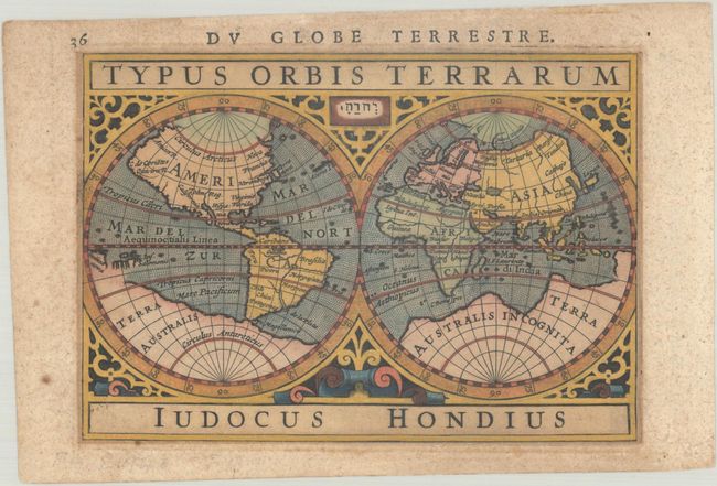
This is Bertius' second miniature world map. It is a double hemisphere based on Mercator's famous world map with several updates by Jodocus Hondius. Terra Australis Incognita fills the Southern Hemisphere and connects to New Guinea in the region of Australia. Mercator's Northwest Passage and interesting polar islands have been replaced with a non-descript landmass. The eastern coast of Asia has been revised to include a Korean Peninsula. The map is richly decorated in a strapwork surround with the cartographer's name boldly engraved below the map. French text on verso.
References: Shirley #291; King (3rd ed.) #1616; Van der Krogt (Vol. III) #0001:342B.
Condition: B+
Light toning and scattered foxing with a bit of mat burn around the image.