Subject: Calais, France
Period: 1695 (circa)
Publication: Les Forces de l'Europe
Color: Hand Color
Size:
10.8 x 7.8 inches
27.4 x 19.8 cm
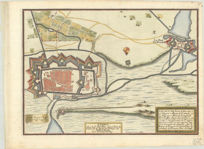
Nicolas de Fer held the title of geographer at Louis XIV's court. He was one of the most prolific publishers of plans of European cities in the late seventeenth century. The fortifications plans in Les Forces de l'Europe were designed to teach fortification techniques. Engraved by Van Loon and Schoonebeek after French engineers under the command of Vauban, the renowned military architect. The illustrations often include a description and a legend with the principal buildings; each city plan includes both fortifications and street layout.
Fine bird's-eye plan of the fortifications at Calais and Fort de Nieulet engraved by Herman van Loon. Nicolas de Fer held the title of Geographer at Louis XIV's court. He was one of the most prolific publishers of plans of European cities in the late seventeenth century.
References: Pastoureau, FER IX [34].
Condition: A
A nice impression on a bright sheet with a coat of arms watermark, minor marginal foxing, and a manuscript page number in upper right margin.