Subject: Scandinavia
Period: 1635 (published)
Publication: Theatrum Orbis Terrarum
Color: Hand Color
Size:
20.9 x 16.8 inches
53.1 x 42.7 cm
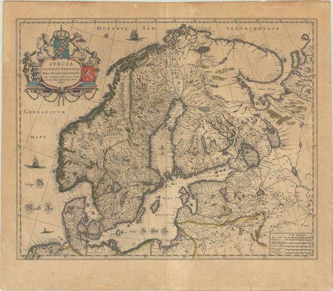
This fine map depicts the kingdoms of Sweden, Denmark and Norway, whose coats of arms are featured within the title cartouche. The map is attributed to Anders Bure (1571-1646), a Swedish cartographer and mathematician. Bure, also known as Andreas Bureus, is best known for his 6-sheet map of Scandinavia and for serving as the first director of the Swedish land survey. The Kingdom of Sweden is shown at its largest extent. The map extends to present day Finland and the Baltic states, and is filled with details of towns, political boundaries, rivers, and topography. Latin text on verso.
References: Van der Krogt (Vol. II) #1210:2.
Condition: B
Full contemporary color with some toning and scattered foxing. There is a remnant of old tape along the left sheet edge on verso, outside of the map image.