Subject: Shetland Islands
Period: 1700 (circa)
Publication: Great Britain's Coasting Pilot…
Color: Black & White
Size:
21.8 x 17.3 inches
55.4 x 43.9 cm
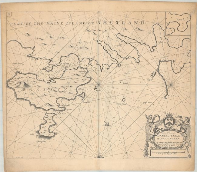
This handsome chart depicts a portion of the eastern coastline of Mainland, as well as islands Bressay and Noss. Only a few place names are identified on the chart, and there are excellent navigational details, such as soundings, rocks, shoals, and anchorages. The map is embellished with half a compass rose orienting north to the right, and a decorative cartouche featuring putti and a dedication to Daniel Finch, 2nd Earl of Nottingham. Engraved by Herman Moll. This is the second state with the plate number "T" added at top left.
In 1681 Capt. Greenville Collins (fl.1669-1694) an officer in the Royal Navy was appointed by the Admiralty to make a complete survey of the coasts of Great Britain. Prior to this date the charts used by English mariners were copies of Dutch charts that had many inaccuracies. The task of surveying the entire coasts was formidable and took about 7 years, at the end of which only 46 surveys were finally used in an atlas titled "Great Britain's Coasting-Pilot Being a New and Exact Survey of the Sea-Coast of England," which was first published in 1693 with editions through 1792.
References: Verner (MCC-58) #40; Shirley (BL Atlases) M.COLL-1a #44.
Condition: B+
A nice impression on a thick sheet with light toning and foxing. There is a small rust spot in the image at top and a faint dampstain at far right.