Current Auction
Lot 39
Current Auction

"Dated Events Map - The World To Day with Latest Boundaries [2nd Edition]", Turner, Stanley
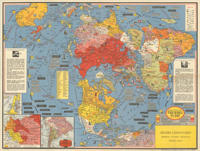
Subject: World

Period: 1948 (circa)

Publication:

Color: Printed Color

Size:
26 x 19.5 inches
66 x 49.5 cm
Download High Resolution Image
(or just click on image to launch the Zoom viewer)

This is a fascinating post-war pictorial map from Stanley Turner, the mapmaker best known for his popular series of World War II Dated Events War Maps. It shows the world on polar projection and is illustrated throughout with flags, ships, planes, wildlife, and more. A legend at top right identifies airports, harbors, airline routes, and various resources, including oil, iron, gold, cattle, and sources of uranium. "Maps that depicted the world of yesterday - even the very recent yesterday - are valueless today except to the student of history," reads the inset text at left. "This Dated Events Map will help you keep abreast of world developments from day to day as they occur." The map recaps the major events of World War II as well as its aftermath, chronicling the "World of Today" up to the spring of 1948. The most recent events mentioned include the assassination of Gandhi and the new state of Israel in Palestine, the suggested partition of which is shown in an inset map at bottom left. Two other inset maps depict Germany under Allied occupation and the rest of South America. A table lists the member countries of the United Nations. Printed in Baltimore by Gettier-Montayne, Inc. Produced by C.C. Petersen Advertising. For a brief article on the Turner maps, click here.

References: Rumsey #8713.009.

Condition: B+

A colorful example, issued folding, with light wear along a few folds. There are a couple of tiny separations and a bit of toning along one fold at center right.

Estimate: $200 - $230

Current High Bid:
$0

Reserve: Reserve Not Met
Next Bid: $100

Bid Increments
$100 - $249$10
$250 - $499$25
$500 - $999$50
$1,000 - $2,499$100
Terms & Conditions