Subject: London, England
Period: 1860 (circa)
Publication:
Color: Hand Color
Size:
32 x 22.9 inches
81.3 x 58.2 cm
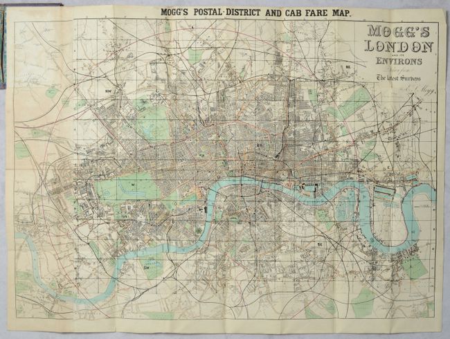
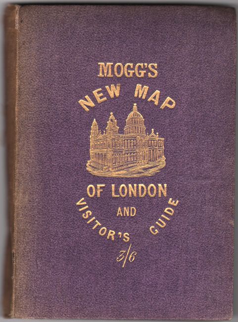
This folding tourist map extends from Hampstead south to Denmark Hill and from Hammersmith east to Greenwich. The River Thames runs across the center of the map, which is precisely engraved down to individual buildings along with parks and cemeteries (green), railroads (black), roads (tan). Given the rapid development and changes occurring in London, instead of issuing new maps, the Mogg brothers would issue updated sections that were to be pasted on top of the original map. The left vertical panel of this map has been updated in this manner and does not include the grid pattern visible in the rest of the map. Accompanied by a 34-page index "to the streets, squares, and cab stands...containing three thousand places." Published by W. Mogg at 62 High Street in Bloomsbury. Linen-backed. Hardbound in blue cloth (4.5 x 6.3") with gilt title on the front cover.
References:
Condition: B+
Issued folding and linen-backed with minor foxing and light toning that is more prominent at left. Covers are lightly sunned and worn, and the spine is split down the middle save for the ends (covers just barely together).