Subject: Central England
Period: 1675 (circa)
Publication: Britannia...
Color: Black & White
Size:
17.3 x 12.3 inches
43.9 x 31.2 cm
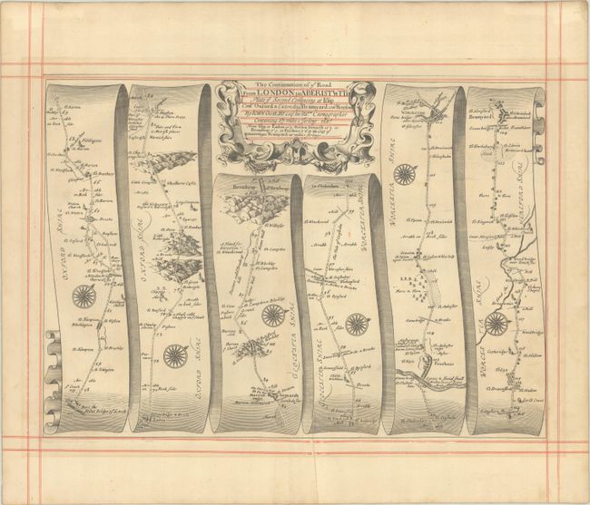
John Ogilby's 'Britannia' was published between 1675 and 1698. It is a landmark in the mapping of England and Wales. Its unique format constituted the first national road-atlas of any country in Western Europe. It was composed of maps of seventy-three major roads and cross-roads, presented in a continuous strip-form, on a uniform scale of one inch to a mile. Each beautiful map includes wonderful detail of the countryside with each strip containing a large compass rose to indicate changes in direction.
Despite mentioning London in the title, this attractive strip-style map actually begins in Islip (Oxfordshire) and continues to Bromyard (Herefordshire) in six strips totaling approximately 67 miles. Each of the six panels has a decorative compass rose to orient the traveler, as well as mileage along the route. Decorated by a strapwork title cartouche at top.
References: Shirley (BL Atlases) T.OGIL-4a #2.
Condition: A
On ruled paper with a Strasbourg Bend & Lily watermark. There is a hint of toning and a printer's crease adjacent to the lower centerfold.