Current Auction
Lot 371
Current Auction

"[Lot of 2] Northumberland, Drawn from an Actual Survey [and] Westmoreland Drawn from ye Best Authorities and Regulated by Astronl. Observatns", Kitchin, Thomas

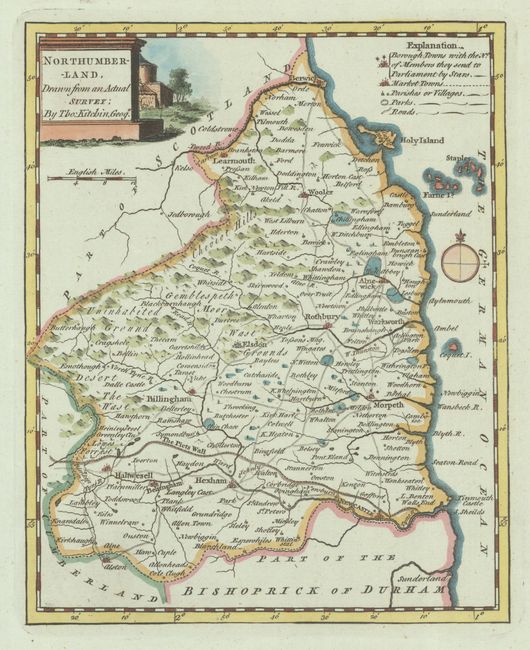
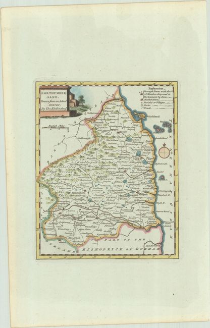
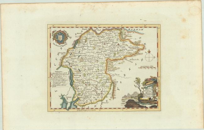
Subject: Northern England

Period: 1749 (circa)

Publication:

Color: Hand Color

Size:
See Description
Download High Resolution Image
(or just click on image to launch the Zoom viewer)

A lovely pair of maps of counties in northern England. Each locates villages, towns, market towns, parks and roads. Hadrian's Wall is prominently depicted on the Northumberland map, and King Arthur's Table is located at the top of the Westmoreland map near Penrith (Cumbria). Both maps are adorned by compass roses and decorative title cartouches.

A. Northumberland, Drawn from an Actual Survey (6.8 x 8.4").
B. Westmoreland Drawn from ye Best Authorities and Regulated by Astronl. Observatns. (8.6 x 6.6").

References:

Condition: A

Crisp impressions with wide margins. The second map has some minor foxing in the blank margins.

Estimate: $100 - $130

Current High Bid:
$0

Reserve: Reserve Not Met
Next Bid: $50

Bid Increments
$50 - $99$5
$100 - $249$10
$250 - $499$25
$500 - $999$50
Terms & Conditions