Subject: Britain
Period: 1710 (circa)
Publication:
Color: Hand Color
Size:
19.2 x 23.6 inches
48.8 x 59.9 cm
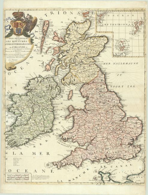
This handsome French map of the British Isles was first published in 1698. The map identifies counties, towns and cities, and watershed. Following the convention in French cartography of the era, it delineates "provinces" in England (North, South, East, West, and Midlands) and Scotland (North and South). Ireland is also divided into its four provinces. An inset at top right depicts the Orkney, Shetland, and Faroe archipelagos. There is a spurious claim at bottom that Nolin has engraved larger maps of England, Scotland, and Ireland. The ornate title cartouche features an angel laying a crown atop a shield featuring the coats of arms of England, Scotland, and Ireland. This is the third state of the map, with no date in the title cartouche and the addition of cardinal lines in the North Sea.
References: Shirley (BI to 1750) Nolin 1.
Condition: B+
A nice impression on paper with a Society of Jesus watermark, light soiling, and minor toning above the centerfold at right. There are archival repairs to a short centerfold separation at left, a small chip in the left margin, and a few short edge tears. Very narrow side margins.