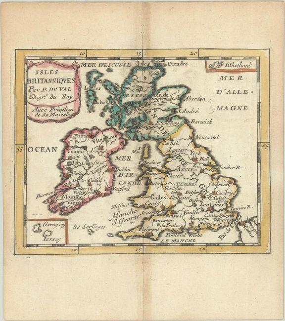
Subject: Britain
Period: 1682 (published)
Publication: Le Monde ou la Geographie Universelle
Color: Hand Color
Size:
5 x 4 inches
12.7 x 10.2 cm
This miniature map of England, Scotland, Wales and Ireland depicts major towns and key topographical features. Two tiny inset maps feature the Shetland Islands and the Channel Islands. This is the second state with some nomenclature added. Pierre Duval was Nicolas Sanson's nephew and pupil. He published a wide range of atlases and individual maps including a fine miniature world geography with many of the maps based on Sanson.
References: King (3rd ed) #1660; Pastoureau, Duval XI Fa.
Condition: B+
A nice impression with original outline color in the map and later color in the cartouche, on a watermarked sheet with light toning along the centerfold and edges of the sheet.