Subject: Britain
Period: 1652 (circa)
Publication:
Color: Hand Color
Size:
20.2 x 15.5 inches
51.3 x 39.4 cm
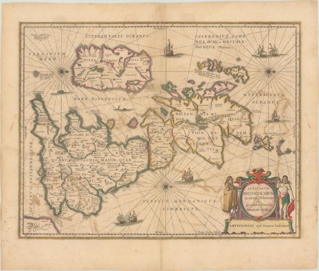
The seas are filled with sailing ships, sea monsters, and compass roses on this handsome map of the British Isles, with north oriented to the right. This is Jansson's historical map of the British Isles after Abraham Ortelius, crisply engraved by Petrus Kaerius. Hadrian's Wall stands as a major feature separating Scotland from England, and the Antonine Wall is noted across the central part of Scotland as well. The interior of the map is filled with place names and charming pictorial topography. The map is further embellished with a large and decorative title cartouche flanked by a Briton and a Celt. This is the second state with the addition of three compass roses and radiating rhumb lines. Blank verso.
References: Shirley (BI to 1650) #466; Van der Krogt (Vol. I) #5000H:1A.
Condition: B
Full contemporary color with light toning and offsetting. Short centerfold separations at top and bottom have been archivally repaired on verso.