
Catalog Archive
Auction 209, Lot 365

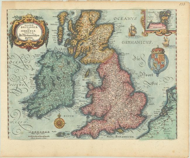
"Magnae Britanniae et Hiberniae Tabulae. Die Britannischen Insulen", Merian, Matthaus
Subject: Britain

Period: 1645 (circa)

Publication:

Color: Hand Color

Size:
13.9 x 10.6 inches
35.3 x 26.9 cm
Download High Resolution Image
(or just click on image to launch the Zoom viewer)

This handsome map of Britain is based on Blaeu's similar map. An inset of the Orkney Islands is enclosed in a strapwork cartouche and the map is beautifully embellished with the royal coat of arms, sailing ships, a compass rose and a garland draped title cartouche. Merian's signature is at bottom right.

References: Shirley (BI to 1650) #489; Shirley (BL Atlases) G.MERI-23a #87.

Condition: B+

A nice impression with a few small spots of foxing. The map has been trimmed to the neatlines and pasted onto a sheet of old paper.

Estimate: $300 - $375

Sold for: $220

Closed on 6/17/2026

Archived