Subject: Europe, World War II
Period: 1939 (circa)
Publication:
Color: Printed Color
Size:
28.5 x 42 inches
72.4 x 106.7 cm
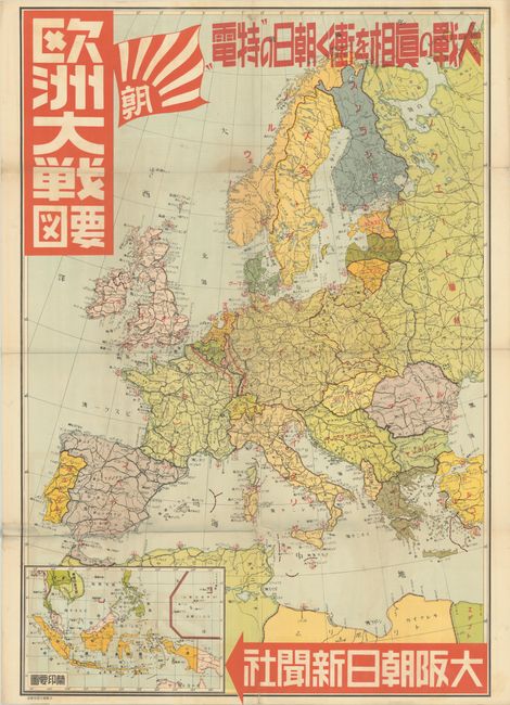
This wall-sized map was published as a supplement to Osaka Asahi Shimbun, a daily newspaper that is one of the oldest newspapers in Japan, and whose flag appears adjacent to the title. It depicts Europe at the beginning of World War II showing the railroad network and marking port cities with red anchors. The Maginot Line and the Siegfried Line are prominently depicted with bold red lines along the French and German borders. At bottom left is an inset map of part of the East Indies, an area of great interest to Japan based on its proposed Greater East Asia Co-Prosperity Sphere. An interesting map published just prior to Japan's engagement in World War II.
References:
Condition: B+
Issued folding with several fold separations that have been closed on verso with Japanese tissue. There is a light stain adjacent to Sweden and another southwest of Portugal, as well as some other minor spots.