Subject: Europe
Period: 1856 (published)
Publication: The Physical Atlas of Natural Phenomena
Color: Hand Color
Size:
23.4 x 19.5 inches
59.4 x 49.5 cm
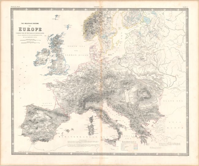
This informative and graphic map presents the continent's elevation through detailed hachuring and extends to include Iceland, western Russia, Greece and western Turkey. The orography is based primarily on the work of Bredsdorf & Olsen. The various mountain systems are grouped in outline color with a key at bottom. Surrounded by a keyboard-style border. Accompanied by a related page of text from the atlas.
Keith Johnston worked in conjunction with German Heinrich Berghaus to produce the Physical Atlas, the first truly comprehensive thematic atlas. The maps from this atlas made a huge impact on cartography in general and specifically on the graphic portrayal of geographical data.
References:
Condition: B+
Contemporary outline color with light toning along the centerfold and some mild foxing.