Subject: Europe
Period: 1676 (published)
Publication: Introductionis in Universam Geographiam
Color: Hand Color
Size:
7.9 x 6 inches
20.1 x 15.2 cm
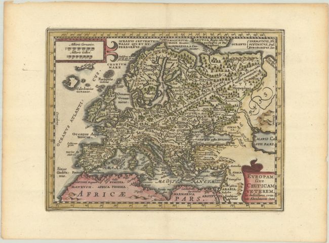
This is a reduced version of Jansson's map of ancient Europe based on the Ortelius map of the same title. The land is fully engraved with forests, mountains, rivers, and numerous ancient place names. Two cartouches balance the corners.
Cluver's Introductio in Universam Geographicam was a popular atlas, appearing in over 45 editions during a 100-year period. The first edition was published without maps in the 1620s, and the first edition to include maps was published circa 1641. The various editions were published in different cities throughout Europe, including Amsterdam, Nuremberg, and London, often with new sets of maps engraved. This map is from an Amsterdam edition published by Jansson's heirs, which included some maps from the Jansson and Cloppenburgh editions of Atlas Minor.
References: Shirley (BL Atlases) T.CLUV-6a #3.
Condition: A
A nice impression on a bright sheet with minor toning along the edges of the sheet.