Subject: North Atlantic
Period: 1746 (dated)
Publication: Allgemeine Historie der Reisen zur Wasser und zu Lande
Color: Hand Color
Size:
17.9 x 12.4 inches
45.5 x 31.5 cm
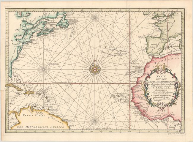
This attractive chart of the North Atlantic is centered on a stunning 32-point compass rose and delineated with rhumb lines. A good portion of each of the continents is shown with major port cities named. The coast of North America is labeled with the colonies Florida, Georgien, Carolina, Virginien, Pensilvanien, Neu England, Neu Scotland, and Acadia. The important fishing banks of North America are prominently depicted. The Prime Meridian is shown through I. Ferro with an alternate Prime Meridian shown through Paris. Published in Johann Joachin Schwabe's German translation of part of Prevost d'Exiles' multi-volume Histoire des Voyages.
References: Shirley (BL Atlases) G.SCHW-1a.
Condition: A
A crisp impression, issued folding on a bright sheet with a Strasbourg lily watermark. A binding trim at bottom left has been replaced with old paper, and an adjacent 1/2" binding tear has been archivally repaired.