Current Auction
Lot 349
Current Auction

"A Map of Groenland", Churchill, John

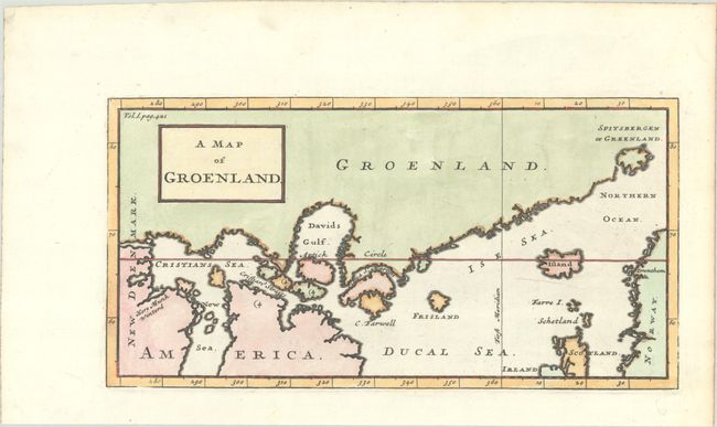
Subject: North Atlantic, Greenland

Period: 1744 (published)

Publication: A Collection of Voyages and Travels

Color: Hand Color

Size:
11 x 5.6 inches
27.9 x 14.2 cm
Download High Resolution Image
(or just click on image to launch the Zoom viewer)

Interesting map of the southern coast of Greenland and the northern waters of the Atlantic Ocean. The map is derived from Isaac la Peyrere's map of 1647. It locates Spitzberg, Iceland, the fictitious Frisland, and the place where "Munk Wintered" at the mouth of the Churchill River on Hudson Bay. Jens Munk led a Danish expedition in search of the Northwest Passage in 1619-20 and was the first to completely map Hudson Bay.

References: Shirley (BL Atlases) G.CHUR-1d #20.

Condition: A+

A sharp impression on a bright sheet with a large "I" watermark and a hint of marginal soiling.

Estimate: $140 - $170

Current High Bid:
$0

Reserve: Reserve Not Met
Next Bid: $70

Bid Increments
$50 - $99$5
$100 - $249$10
$250 - $499$25
$500 - $999$50
Terms & Conditions