Subject: Eastern Atlantic Ocean
Period: 1680 (circa)
Publication:
Color: Hand Color
Size:
23.1 x 20.1 inches
58.7 x 51.1 cm
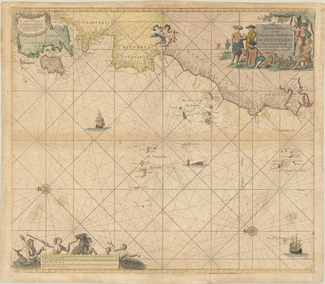
Splendid sea chart of the eastern Atlantic with the coastlines from Britain through Cape Verde. The map is highly decorative with a large cartouche showing European and African traders, a garland imprint cartouche, a putti holding a coat of arms, Neptune adorning the scale cartouche, two sailing ships, two compass roses, a sea monster and rhumb lines.
References:
Condition: B
A nice impression on a lightly toned, speckled sheet with more noticeable toning along the centerfold. There are four dark spots in the bottom third of the image that have been covered up on recto with 1/2" to 3/4" sized pieces of old paper with the missing rhumb lines replaced in facsimile.