Subject: South Atlantic
Period: 1746 (dated)
Publication: Allgemeine Historie der Reisen zur Wasser und zu Lande
Color: Hand Color
Size:
17.8 x 13.4 inches
45.2 x 34 cm
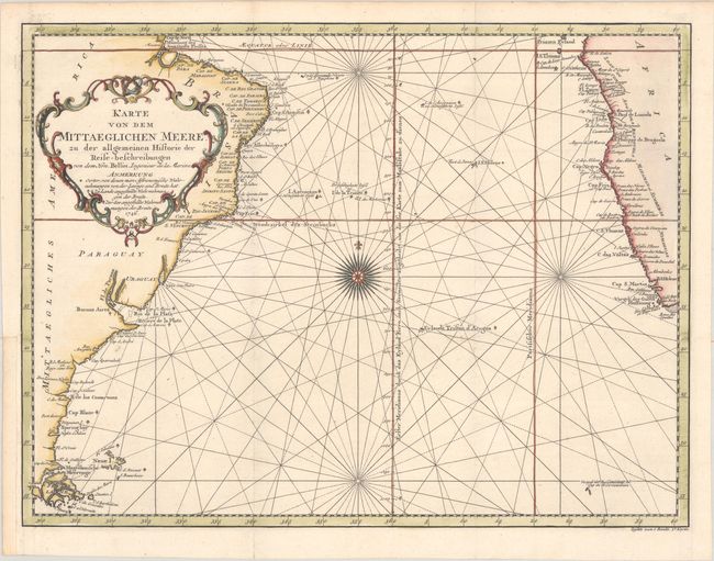
This attractive chart of the South Atlantic is centered on a large compass rose with rhumb lines radiating across the ocean. A good portion of the coastlines of South America and Africa are shown with major port cities named. The Prime Meridian is shown through Eyland Ferro and the Meridian of Paris is shown just west of the coast of Africa. A large rococo title cartouche graces the otherwise blank interior of South America. Published in Johann Joachin Schwabe's German translation of part of Prevost d'Exiles' multi-volume Histoire des Voyages.
References: Shirley (BL Atlases) G.SCHW-1a.
Condition: A
A crisp impression, issued folding on a bright, watermarked sheet. A binding trim at bottom left has been replaced with old paper, and an adjacent 1/4" binding tear has been archivally repaired.