Subject: Lesser Antilles
Period: 1787 (circa)
Publication: Atlas Encyclopedique...
Color: Hand Color
Size:
13.5 x 9.5 inches
34.3 x 24.1 cm
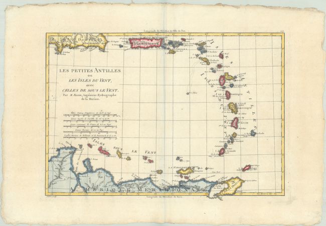
Nicely engraved map depicting most of the Lesser Antilles from Anguilla to Grenada, including the Windward and Leeward Islands. Scope extends to include Trinidad and the northern coastline of South America. Features four distance scales below the title. Finely engraved by Andre.
Rigobert Bonne was an important French cartographer of the late 18th century. In 1773 he succeeded Jacques Bellin as the Royal Cartographer in the Office of the Hydrographer at the Depot de la Marine. Working in his official capacity, Bonne compiled some of the most detailed and accurate maps of the period.
References: Phillips (Atlases) #666, Vol. 2 #109; Sellers & Van Ee #1964.
Condition: A
A crisp impression on watermarked paper with a bit of creasing adjacent to the centerfold.