Subject: World
Period: 1838 (dated)
Publication:
Color: Hand Color
Size:
28 x 19 inches
71.1 x 48.3 cm
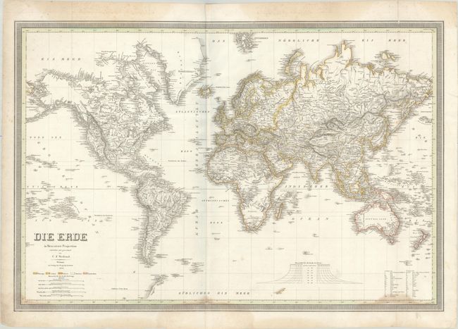
This impressive and uncommon German map of the world features nice topographical detail and plenty of place names. In the Great Basin region of the United States, two conjectural rivers extend from the lakes Timpanogos and Tegujo to the Pacific. Texas appears to still be under Mexican control. The interior of Alaska is entirely blank, with all detail confined to the coasts. Inland Australia is similarly bereft of detail, and unknown regions are labeled in the Ethiopian highlands and southern Africa. Fragments of coastline represent early Antarctic discoveries, including Graham's Land 1832 and Enderby's Land (1831). Continents are color-coded with a key below the title. The map also includes 5 distance scales, a scale for the degrees of latitude, and a key identifying various abbreviations. Surrounded by a keyboard-style border. Published by the Geographisches Institut.
References:
Condition: B
Contemporary outline color with moderate dampstaining at bottom and in the border at top. There is minor foxing and soiling, a tiny hole at bottom right, and two 0.5" tears around the centerfold that have been closed with archival tape on verso.