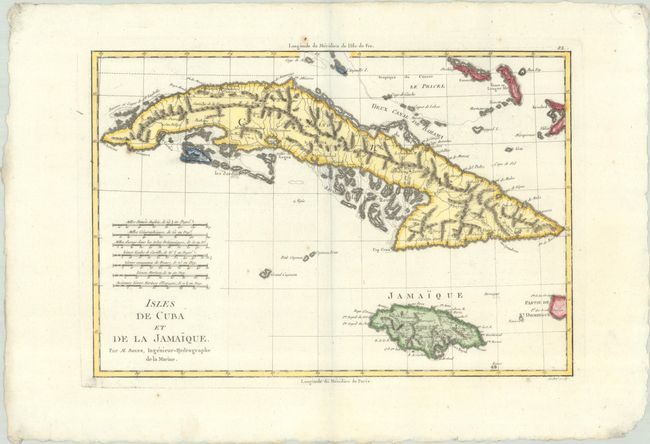
Subject: Cuba & Jamaica
Period: 1787 (circa)
Publication: Atlas Encyclopedique...
Color: Hand Color
Size:
13.6 x 9.3 inches
34.5 x 23.6 cm
This simple but handsome copper engraved map features nice topographical detail of Cuba and Jamaica. The map includes the Caymans and part of the Bahamas. It includes seven different distance scales. Engraved by Andre.
Rigobert Bonne was an important French cartographer of the late 18th century. In 1773 he succeeded Jacques Bellin as the Royal Cartographer in the Office of the Hydrographer at the Depot de la Marine. Working in his official capacity, Bonne compiled some of the most detailed and accurate maps of the period.
References: Cueto #51; Phillips (Atlases) #666, Vol. 2 #112.
Condition: A
A crisp impression on a clean sheet with a few faint spots.