Subject: Caribbean & Central America
Period: 1935 (circa)
Publication: Our U.S.A. - A Gay Geography
Color: Printed Color
Size:
11.8 x 8.6 inches
30 x 21.8 cm
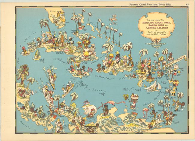
This playful "cartograph" was issued in White's Our U.S.A. - A Gay Geography. It covers the Caribbean and Central America, extending to show the southern tip of Florida and northern South America. The Panama Canal Zone is highlighted red, flanked by an American soldier and a Panamanian with a few hats stacked on his head. Cartoon illustrations fill the map, with the unfortunate racial caricatures typical of the era. A decorative title cartouche fills the top right corner.
Ruth Taylor White's charming pictorial maps are among the most popular collectible maps of the early 20th century. Shortly after the publication of the first edition of Our U.S.A. - A Gay Geography in 1935, the New York Times reviewed it as follows: "Any one who remembers his childhood efforts to visualize Kentucky as something more than the green spot on the map, or New York as the pink State, will appreciate this volume. Brilliantly colored pictorial maps of the same order which have been amusing adults for the past decade show the United States and their Territories as active, picturesque entities" (November 17th, 1935).
References: Rumsey #7823.086.
Condition: A
Clean and colorful, with a hint of toning and binding holes in the left margin.