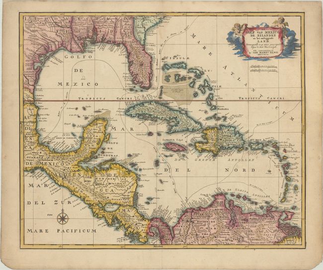
Subject: Gulf of Mexico & Caribbean
Period: 1792 (dated)
Publication:
Color: Hand Color
Size:
22.7 x 18.8 inches
57.7 x 47.8 cm
This uncommon chart covers the Gulf of Mexico and the Caribbean including Florida, Central America, and the northern part of South America. It provides good detail including several Indian place names in Louisiana and Florida. The Mississippi River is boldly shown and New Orleans is curiously missing. The routes of the Spanish galleons are prominently noted. The map is decorated with a compass rose and a title cartouche held aloft by putti.
References: Phillips (Atlases) 674-39.
Condition: B+
A sharp impression with contemporary color in the map and later color in the cartouche, on a lightly toned sheet with a pair of elephant watermarks. There is minor soiling that is more prominent along the edges of the sheet, and small chips in the bottom corners of the sheet.