Subject: Southern Mexico, Central America & the Caribbean
Period: 1706 (circa)
Publication: De Gedenkwaardige en al-om Beroemde Voyagien der Spanjaarden na West-Indien...
Color: Black & White
Size:
8.8 x 12.5 inches
22.4 x 31.8 cm
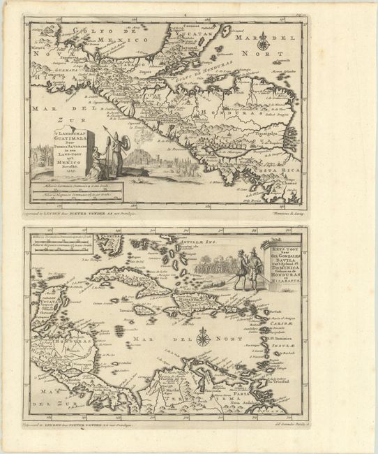
This sheet featuring two exquisite maps appeared in the second volume of Van der Aa's collection on the Spanish in the Americas. The map at top shows the lands conquered under Spanish conquistador Pedro de Alvarado, extending from southern Mexico and the Yucatan south through Guatemala, Nicaragua, and portions of Costa Rica. There is good coastal detail and the interior is filled with numerous towns and villages, river systems, and pictorial topography. Decorated by a title cartouche depicting Indian warriors, a fortified city, and an erupting volcano. Below is another map covering all of the West Indies, the southern tip of Florida, and the Yucatan through northern South America. The map was used to illustrate the account of Spaniard Gil Gonzales Davila, who from 1520 to 1525 explored the region north of Costa Rica that would become Nicaragua and Honduras. The map is decorated by a title cartouche featuring two Spanish explorers with a battle raging in the background. Both maps include a compass rose and two distance scales.
References:
Condition: A
Dark impressions with minor spots in the blank margins.