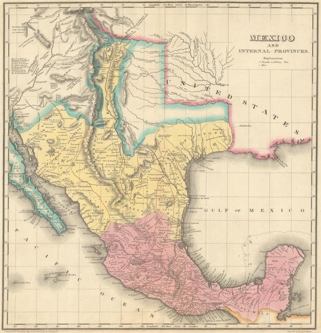
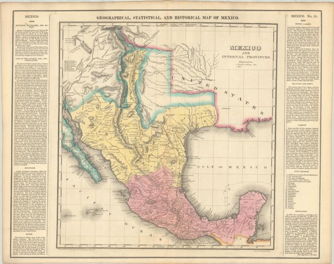
Subject: Southwestern United States & Mexico, Texas
Period: 1827 (published)
Publication: A Complete Historical, Chronological, and Geographical American Atlas
Color: Hand Color
Size:
14.6 x 15.1 inches
37.1 x 38.4 cm
This detailed map of Mexico, Texas, and the American Southwest is one of the earliest detailed maps of the region. It is based largely on Von Humboldt's important map (1804), and does not show any Anglo settlement in Texas yet despite the 1827 publication date. The settled parts of Texas are confined along the Gulf of Mexico and the Rio Grande River, with the northern area blank except for a few rivers and the Spanish Trail from the Red River to Santa Fe. Presidio de Bejar (San Antonio) is noted as "Capital of the Province of Texas." The northern portion of the map covers the little-known parts of present-day Utah, Arizona, and New Mexico and notes "the Western limits of this Salt Lake are unknown" (Great Salt Lake) . It shows several fictitious geographical features in the Great Basin, and notations that were compiled by the Escalante expedition of 1776-77. The Santa Cruz River of southern Arizona is still not shown, and Tucson is misspelled Tubson. The map identifies topographic features, mines, presidios, military posts, and Native American tribes. The title within the map is Mexico and Internal Provinces. Flanked by text describing the newly independent Mexico including boundaries, soils, climate, and political divisions. Drawn by J. Finlayson and engraved by Young and Delleker. On a full sheet of English text measuring 21.9 x 17.5".
References: Harkins et al (Texas Takes Shape) pp. 96-97; Phillips (Atlases) #1177.
Condition: A
Contemporary color on a clean sheet with a short archivally repaired fold separation at bottom outside of the map image.