Subject: Southwestern United States & Mexico, California
Period: 1682 (published)
Publication: Le Monde ou la Geographie Universelle
Color: Hand Color
Size:
4.8 x 3.9 inches
12.2 x 9.9 cm
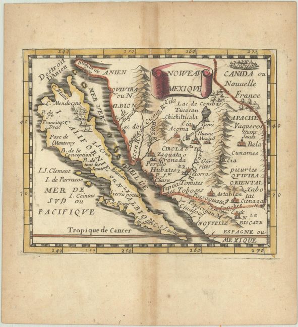
The island of California is the main focus of this charming miniature map. The map is filled with place names including the mysterious seven cities of Cibola. The R. de Nort (Rio Grande) originates from a large Lac de Conibas and incorrectly flows into the Mer Vermeille. The map is based on Sanson's Audience de Guadalajara (1657) with the addition of the Destroit d'Anien above the island and several unnamed, north-south, mountain ranges on the mainland. This is the third state with much new nomenclature added on California and Nouvelle Espagne ou Mexique added at lower right. Pierre Duval was Nicolas Sanson's nephew and pupil. He published a wide range of atlases and individual maps including a fine miniature world geography with many of the maps based on Sanson.
References: Burden #353; McLaughlin #30; King (3rd ed) #1660; Pastoureau, Duval XI Fa.
Condition: B+
A nice impression with original outline color in the map and later color in the cartouche, on a watermarked sheet with light toning along the centerfold and edges of the sheet. There are a number of minute worm holes that are only visible when held to light.