Subject: Southern United States, Mexico & Central America
Period: 1787 (circa)
Publication: Atlas Encyclopedique...
Color: Hand Color
Size:
9.3 x 13.6 inches
23.6 x 34.5 cm
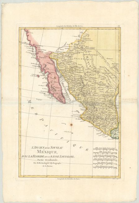
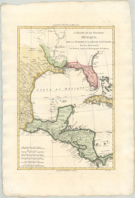
This handsome pair of maps covers the southern United States, Mexico, and Central America. There is good detail along the Gulf Coast, including the Mississippi River to above its conjunction with the Ohio River. The Jesuit missions and numerous Indian tribes are well depicted in Mexico and the Southwest. The map locates San Diego, Santa Fe, Taos, Acapulco, Cabo St. Lucas, and many towns along the Sea of Cortez and the Baja Peninsula. Engraved by Andre.
Rigobert Bonne was an important French cartographer of the late 18th century. In 1773 he succeeded Jacques Bellin as the Royal Cartographer in the Office of the Hydrographer at the Depot de la Marine. Working in his official capacity, Bonne compiled some of the most detailed and accurate maps of the period.
References: Phillips (Atlases) #666, Vol. 2 #115 & 116.
Condition:
Crisp impressions on watermarked paper with wide margins. The western map has a couple of rust spots in the image. Western map (B+) / Eastern map (A)