Subject: World
Period: 1804 (dated)
Publication:
Color: Hand Color
Size:
28.7 x 17.2 inches
72.9 x 43.7 cm
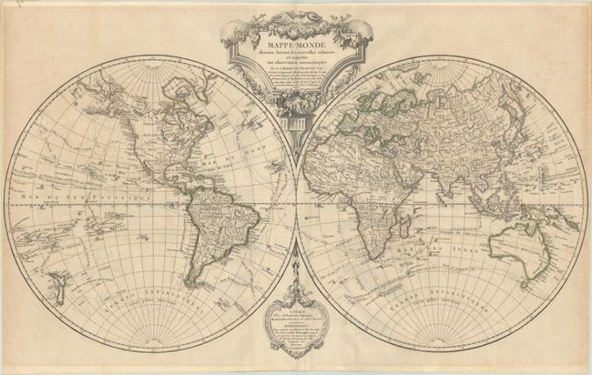
This is a later state of this attractive double-hemisphere world first issued in 1749. The map has been updated with information, particularly the additional discoveries of Cook, La Perouse, Vancouver, and Mackenzie to the year 1802 as noted in the title cartouche. With these discoveries now reflected in the map, we no longer see the notion of a Northwest Passage. However, several rivers extend through the Pacific Northwest, including Baron Lahontan's fictitious R. Longue. The Mississippi, Missouri and Platte Rivers are conflated, and an unnamed river extends from Cape Mendocino on the Pacific Coast well into the interior of the continent. The tracks of explorations and trade routes are shown in detail throughout the oceans. The antipode of the European continent is superimposed over the South Pacific Ocean. The large title cartouche is draped with a garland of flowers. Originally by the Robert de Vaugondy family, this map was reissued by their successor, Charles Francois Delamarche.
References: cf. Pedley #6.
Condition: B+
A crisp impression with original outline color on a lightly toned sheet with the watermark of "Ambert C [heart] Fenero." There is light foxing, extraneous creasing, and remnants of non-archival tape residue (not tacky) along the edges of the sheet on verso.