Subject: World
Period: 1803 (published)
Publication: The Chronology and History of the World
Color: Black & White
Size:
27.7 x 16.1 inches
70.4 x 40.9 cm
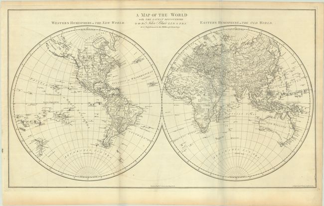
An attractive, double-hemispheric map of the world. In North America, the United States is named and confined east of the Appalachian Mountains. Further west are the large regions of Louisiana and New Mexico, and a dotted line connects the Missouri River to the Columbia River. While the Alaskan coastline is still evolving, the Aleutian Islands are well developed. In South America, the mythical Lake Xarayes and L. Parima are still depicted. The southern coastline of Australia is noted as "unknown coast," though Tasmania is correctly shown as an island. Engraved by J. Bayly. The map is dated 1779 and was published in the 1803 edition of John Blair's The Chronology & History of the World.
Blair's Chronology went through many editions well into the 19th century, with maps added beginning in the 1768 editions to help illustrate lands covered by the work, both ancient and modern. Over time, most of the maps show little or no revision between the various editions.
References: Shirley (BL Atlases) G.BLAI-1b #1a.
Condition: B+
A crisp impression on a sheet with Strasbourg Lily watermark. There is some faint offsetting and a few faint spots. Issued folding.