Subject: Montana
Period: 1957 (dated)
Publication:
Color: Printed Color
Size:
27.3 x 18.7 inches
69.3 x 47.5 cm
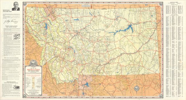
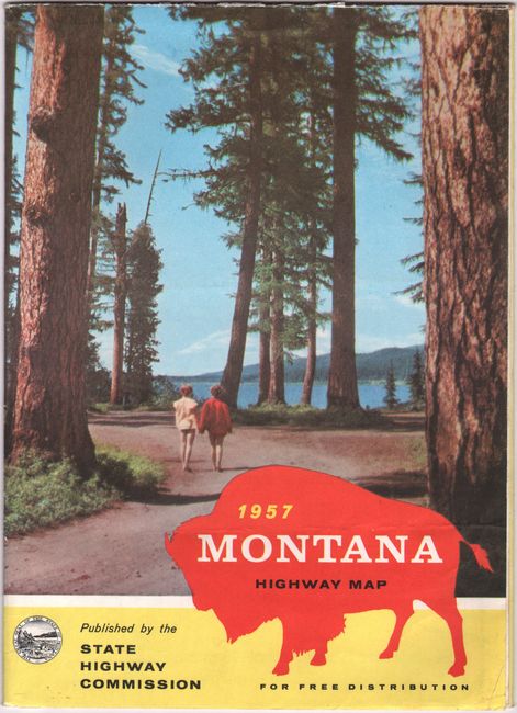
A colorful and detailed highway map published by the Montana State Highway Commission. It delineates paved, improved, graded and dirt roads along with parks, points of interest, campsites, and even "agricultural experiment stations." The map extends into northern Wyoming and eastern Idaho and locates both Yellowstone and Glacier National Parks. The compass rose, title and map corners all feature the state seal. Flanked by travel related text at left and a street index at right. The verso includes related text, illustrations, and a mileage table. Self-folding (6.5 x 9.0") with pictorial wrappers.
References:
Condition: B+
A colorful example with a few short separations around the fold junctions. Issued folding.