Subject: World
Period: 1785 (circa)
Publication: Atlas de Toutes les Parties Connues du Globe Terrestre
Color: Black & White
Size:
15.9 x 8.5 inches
40.4 x 21.6 cm
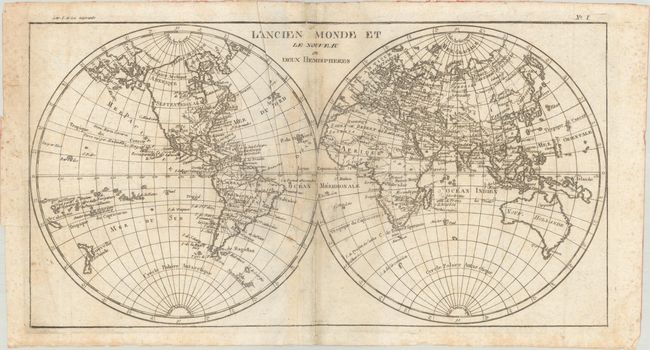
Attractive double hemisphere world map. In North America, the United States is named and confined along the eastern seaboard. The entire western region is blank with the only place names being Santa Fe and Cape Mendocino. There is a large group of islands in the North Pacific including Alaschka in the vicinity of Alaska. Tasmania is attached to Australia, and both islands of New Zealand are depicted.
Rigobert Bonne was an important French cartographer of the late 18th century. In 1773 he succeeded Jacques Bellin as the royal cartographer in the Office of the Hydrographer at the Depot de la Marine. Working in his official capacity, Bonne compiled some of the most detailed and accurate maps of the period.
References:
Condition: B
There is some light toning and extraneous creasing along the centerfold and some minor foxing mostly along the sheet edges. The paper is thin and has been reinforced with binder's tape along the centerfold.