Subject: Washington, D.C.
Period: 1935 (circa)
Publication: Our U.S.A. - A Gay Geography
Color: Printed Color
Size:
11.7 x 8.6 inches
29.7 x 21.8 cm
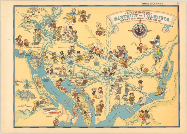
This charming "cartograph" was issued in White's Our U.S.A. - A Gay Geography. It is filled with cartoonish illustrations representing the capital city's culture and landmarks, including the Capitol (with a senator and representative), the White House, the Smithsonian, the Washington Monument, the Lincoln Memorial, the Tomb of the Unknown Soldier, and much more. Children race boats in the Reflecting Pool; foreign ambassadors convene in Dupont Circle; a lobbyist makes his case south of the Capitol; and tourists arrive in Union Station. The map features unfortunate racial caricatures typical of the period. It is further decorated by a banner-style cartouche and a compass rose that incorporates Uncle Sam.
Ruth Taylor White's lighthearted pictorial maps are among the most popular collectible maps of the early 20th century. Shortly after the publication of the first edition of Our U.S.A. - A Gay Geography in 1935, the New York Times reviewed it as follows: "Any one who remembers his childhood efforts to visualize Kentucky as something more than the green spot on the map, or New York as the pink State, will appreciate this volume. Brilliantly colored pictorial maps of the same order which have been amusing adults for the past decade show the United States and their Territories as active, picturesque entities" (November 17th, 1935).
References: Rumsey #7823.026.
Condition: A
Clean and bright with a hint of toning and binding holes along sheet's left edge.