Subject: World
Period: 1730 (circa)
Publication:
Color: Black & White
Size:
23.6 x 20.4 inches
59.9 x 51.8 cm
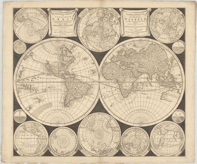
This stunning world map was published at a time when the traditional baroque ornamentation of the late Dutch period was waning. In place of allegorical imagery, Carel Allard took a more scientific, yet visually dramatic style by incorporating eight smaller hemispherical projections depicting the world from various perspectives, and four still smaller circular diagrams. The dark cross-hatched engraved background provides a striking contrast to the finely engraved maps. This new style was copied by several early 18th century cartographers including Schenk, Homann and Lotter.
Cartogrpahically, the map portrays the island of California on the Sanson model beside a coastline stretching between North America and Asia named Terra Esonis. Australia (Hollandia Nova), Tasmania, and New Zealand are only partially delineated, and there appears to be confusion with the coastlines of Carpentaria and Quiri Regio shown in the western hemisphere near New Guinea. There are two drape-style title cartouches, one in Latin and the other in Dutch. Originally published by Allard in 1696, this is the Covens & Mortier re-issue with their imprint added in both cartouches.
References: Shirley #578.
Condition: A
A sharp impression on a thick, deckle-edged sheet with marginal soiling.