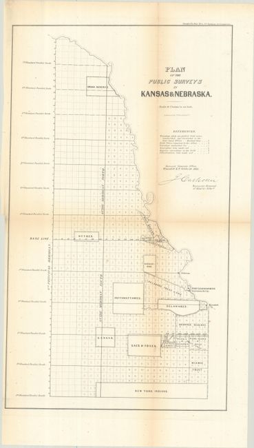
Subject: Eastern Kansas & Nebraska
Period: 1856 (dated)
Publication: Sen. Ex. Doc. 5, 34th Congress, 3rd Session
Color: Black & White
Size:
11.5 x 19.8 inches
29.2 x 50.3 cm
This map was prepared for the Annual Report of the Surveyor General and presents the government's rapid surveying efforts in eastern Kansas and Nebraska. Issued two years after the Kansas-Nebraska Act established these two territories, it locates numerous Indian lands reserved for various groups including the Pottawattamies, Delaware, Sacs & Foxes, "Half Breeds," and New York Indians, all of which are sandwiched between townships in varying degrees of completion. Drawn on a scale of 18 chains per inch. Signed in the plate by John Calhoun and lithographed by Ackerman in New York.
References:
Condition: B+
Issued folding with light toning along the fold lines. There is a binder's trim at lower left.