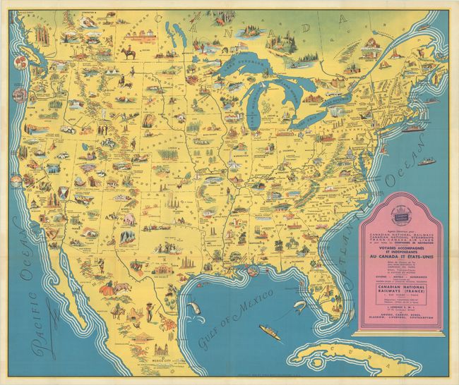
Subject: North America
Period: 1936 (dated)
Publication:
Color: Printed Color
Size:
31.1 x 26.1 inches
79 x 66.3 cm
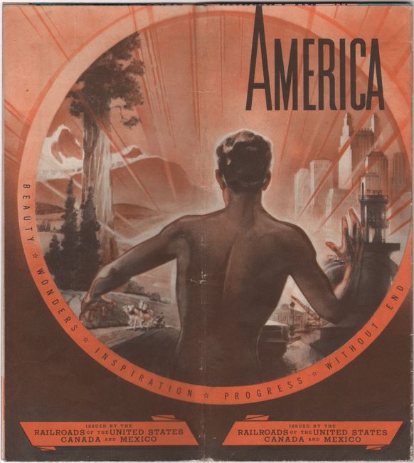
This full-color pictorial map of North America is filled with charming vignettes and figures. Both tourist destinations and local resources are highlighted including Yellowstone, Yosemite, Grand Canyon, and The Alamo to name a few. A large table of distances from New York, Boston, Montreal, and Norfolk to points west fills the Atlantic Ocean. While the map is completely in English, the highly illustrated verso contains French text - clearly designed to draw a French audience to America, which became a much shorter journey with the advent of commercial aviation. An English text edition was also published. Printed by the Poole Brothers in Chicago.
References:
Condition: A
A crisp and colorful example, issued folding.