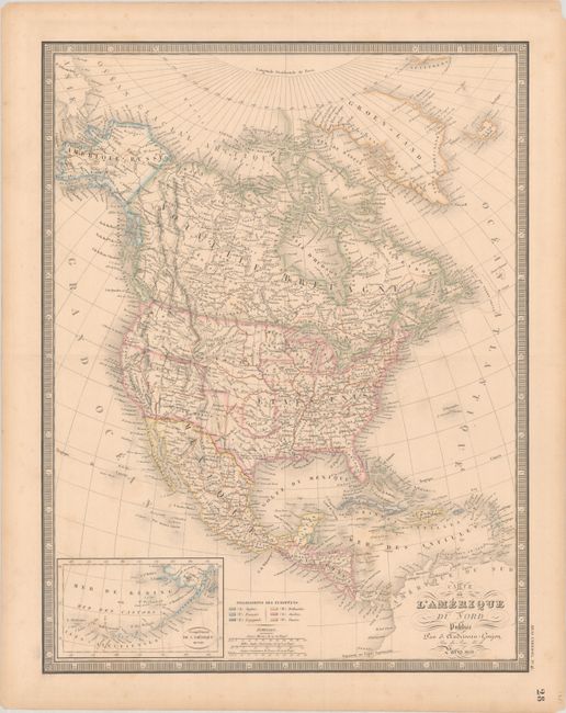
Subject: North America
Period: 1851 (dated)
Publication: Atlas Universel
Color: Hand Color
Size:
15.2 x 19.7 inches
38.6 x 50 cm
This 19th century map of the continent shows the United States in an evolving configuration. The map shows good detail of settlements, rivers, and the locations of Indian tribes. Unlike earlier editions of the map, this edition delineates state and territorial boundaries. In the Southwest, New Mexico Territory extends to encompass present-day Arizona and southern Nevada. To its north is a large Utah Territory showing a large Lac Timpanogos ou Lac Sale. The Oregon boundary dispute has been settled, with the boundary between the United States and Canada falling on the 49th parallel. North of Texas are the Ozark, Osage, and Mandan districts and Nebraska Territory. At lower left is an inset of the Aleutian Islands and Bering Sea. The color-coded key at bottom identifies European colonial holdings.
References:
Condition: B+
Contemporary outline color on a lightly toned sheet with minor foxing and a tiny wormhole near top.