Subject: North America
Period: 1797 (circa)
Publication: Brown's General Atlas
Color: Hand Color
Size:
13.1 x 11.3 inches
33.3 x 28.7 cm
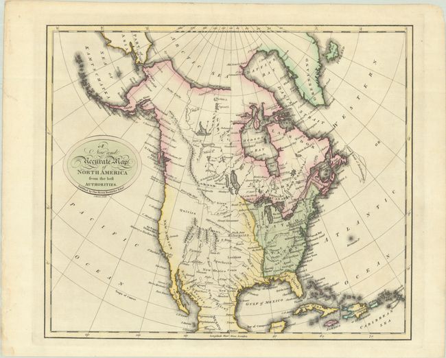
This scarce map of North America was published in the first general atlas published in Scotland and depicts some interesting cartography. The United States is shown extending to the Mississippi River, with the Appalachian Mountains extending south of present-day Atlanta. The Rocky Mountains are shown as four short, parallel mountain ranges. A River of the West connects to the R. Oregan, which nearly connects to the Mississippi River via the Moine or Salt R. (Des Moines River). Cenis and New Leon are located in present-day Texas, and California is labeled New Albion. Quivira is located in between the River of the West and the Rockies. Indian tribes are named throughout. Engraved by J. Menzies.
References:
Condition: A
A crisp impression with contemporary color on paper with a "1797 HM" watermark. There is an archivally repaired edge tear confined to the left blank margin and a couple of short printer's creases in the top margin.