Subject: Colonial North America
Period: 1780 (circa)
Publication: Atlas de Toutes les Parties Connues du Globe Terrestre
Color: Hand Color
Size:
12.6 x 8.3 inches
32 x 21.1 cm
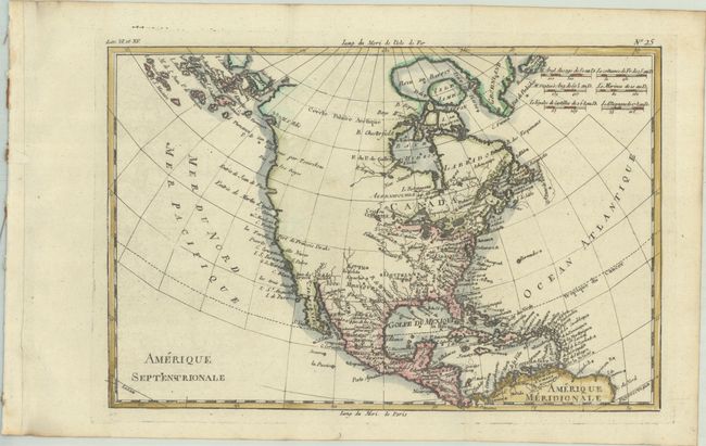
The entire western part of the continent is left mostly blank on this map of North America. Indian tribes occupy the edges of defined territory, including Apaches, Sioux, Outagamis, and Assenipouels. The British Colonies and a few major cities are named along the eastern seaboard and in the Great Lakes region. Alaska is shown as a group of islands, the largest of which is labeled Alaschka. Place names fill Mexico and the Caribbean.
Rigobert Bonne was an important French cartographer of the late 18th century. In 1773 he succeeded Jacques Bellin as the royal cartographer in the office of the Hydrographer at the Depot de la Marine. Working in his official capacity, Bonne compiled some of the most detailed and accurate maps of the period.
References: Sellers & Van Ee #170.
Condition: A
A dark impression, issued folding on a bright sheet with a "CB" watermark, binding holes along the left edge of the sheet, and minor toning along the edges of the sheet.