Subject: Colonial North America
Period: 1760 (circa)
Publication: Geographical Atlas
Color: Hand Color
Size:
13.9 x 13.4 inches
35.3 x 34 cm
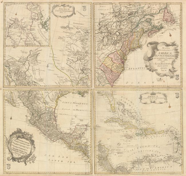
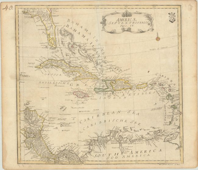
This is Euler's scarce four-sheet map of North America. Each sheet stands on its own with a title cartouche and full borders. Euler's engraved "cum privilegio" stamp appears on each sheet. If joined, the map would measure approximately 28 x 27".
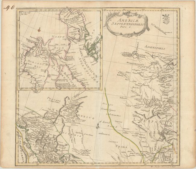
Pars I covers the region from the Mississippi River valley through the American Southwest. It presents a detailed view of French Louisania and the Spanish possessions in New Mexico with a Great Space of Land Unknown and Tecas in between. A notation on a river flowing into Lake of the Woods (The Wood Lake) remarks, "Great River coming from the West discovered lately by the Oshages Savages." A large inset map illustrates Hudson and Baffin Bays with numerous English notations concerning discoveries in the region.
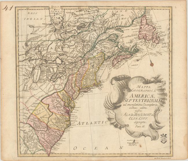
Pars II shows the British and French possessions from Georgia to Newfoundland and Labrador. The colonies are shown in odd configurations and the Appalachian Mountains weave in an interesting formation through the Mid-Atlantic and South. Numerous Indian tribes are noted throughout, and the fishing banks along the coast of Canada are well depicted.
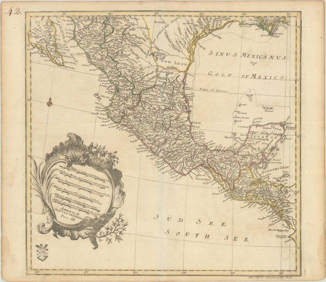
Pars III covers the region from the Gulf Coast of the U.S. through Mexico to Honduras, and presents a detailed view of the Spanish possessions in New Mexico with the note Country Not Particularly Known in Texas.
Pars IV depicts the Caribbean and Central America with good detail of place names, islands, shoals and reefs. The map extends north to Cumberland Island, Georgia and west to Pensacola, Florida. Florida is quite narrow with southern Florida depicted as a series of large islands. A number of rivers and small lakes fill the peninsula. In contrast, there is little inland detail in South America, where Lake Maracaibo is given an elongated, narrow shape.
References: McCorkle #775.4; Sellers & Van Ee #86.
Condition: B+
Contemporary color on watermarked paper with manuscript page numbers in the top left sheet corners. There is some light toning and a few faint spots. The first image is a composite image - the map is in four separate sheets.