Subject: Western Hemisphere - America
Period: 1811 (circa)
Publication: New General Atlas
Color: Hand Color
Size:
20.2 x 18.1 inches
51.3 x 46 cm
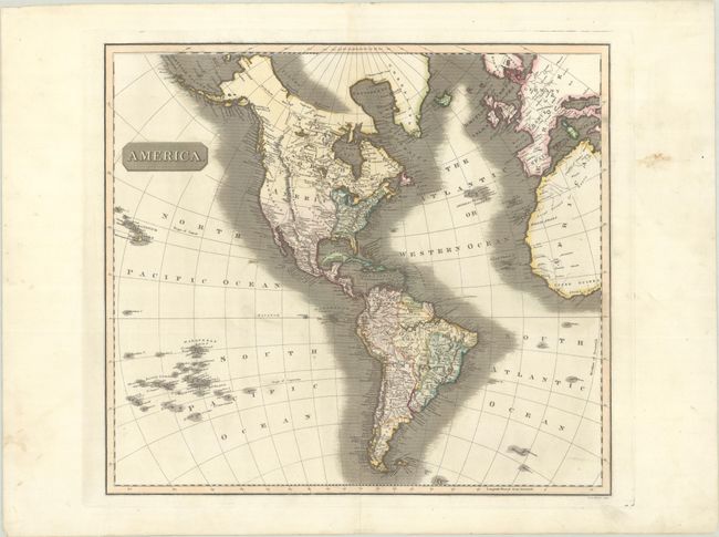
This well-engraved map shows the latest discoveries, including those of Mackenzie, Hearne, and Lewis & Clark. The map extends to include the coasts of Europe and West Africa, and it presents good detail of islands in the eastern portion of the South Pacific. The United States is shown north of East and West Florida, and east of the Mississippi River. The land west of the Mississippi is called Louisiana, and the northwest portion (New Albion) of the continent is largely devoid of detail. Hawaii is named Sandwich Isles and Aliaska is depicted in a rudimentary shape. Engraved by J. & G. Menzies.
References:
Condition: A
A dark impression with full contemporary color on a bright sheet of wove paper with the watermark of "J. Whatman 1811." There is a bit of printer's ink residue, a pair of tiny wormholes that have been professionally infilled, and marginal soiling.